


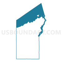
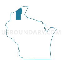
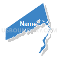
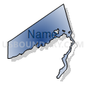
WATER Voting District, Bayfield County, Wisconsin
About
Outline

Summary
| Unique Area Identifier | 692359 |
| Name | WATER Voting District |
| County | Bayfield County |
| State | Wisconsin |
| Area (square miles) | 528.45 |
| Land Area (square miles) | 0.10 |
| Water Area (square miles) | 528.35 |
| % of Land Area | 0.02 |
| % of Water Area | 99.98 |
| Latitude of the Internal Point | 46.88833770 |
| Longtitude of the Internal Point | -91.04076810 |
Maps

Graphs
Select a template below for downloading or customizing gragh for WATER Voting District, Bayfield County, Wisconsin


Neighbors
Neighoring Voting District (by Name) Neighboring Voting District on the Map
- Amnicon - T 9999 Voting District, Douglas County, WI
- BARKSDALE - T 1 Voting District, Bayfield County, WI
- Bayfield - C 1 Voting District, Bayfield County, WI
- Bayfield - C 4 Voting District, Bayfield County, WI
- BAYFIELD - T 1 Voting District, Bayfield County, WI
- BAYVIEW - T 1 Voting District, Bayfield County, WI
- BELL - T 1 Voting District, Bayfield County, WI
- CLOVER - T 1 Voting District, Bayfield County, WI
- CLOVERLAND - T 1 Voting District, Douglas County, WI
- EILEEN - T 2 Voting District, Bayfield County, WI
- ORIENTA - T 1 Voting District, Bayfield County, WI
- PORT WING - T 1 Voting District, Bayfield County, WI
- RUSSELL - T 1 Voting District, Bayfield County, WI
- Voting Districts not defined, Lake County, MN
- Washburn - C 1 Voting District, Bayfield County, WI
- Washburn - C 2 Voting District, Bayfield County, WI
- Washburn - C 4 Voting District, Bayfield County, WI
- WATER Voting District, Ashland County, WI
Top 10 Neighboring County Subdivision (by Population) Neighboring County Subdivision on the Map
- Washburn city, Bayfield County, WI (2,117)
- Russell town, Bayfield County, WI (1,279)
- Barksdale town, Bayfield County, WI (723)
- Eileen town, Bayfield County, WI (681)
- Bayfield town, Bayfield County, WI (680)
- Bayview town, Bayfield County, WI (487)
- Bayfield city, Bayfield County, WI (487)
- Port Wing town, Bayfield County, WI (368)
- Bell town, Bayfield County, WI (263)
- Clover town, Bayfield County, WI (223)
Top 10 Neighboring Place (by Population) Neighboring Place on the Map
- Washburn city, WI (2,117)
- Bayfield city, WI (487)
- Port Wing CDP, WI (164)
- Herbster CDP, WI (104)
- Cornucopia CDP, WI (98)
Top 10 Neighboring Unified School District (by Population) Neighboring Unified School District on the Map
- Lake Superior Public School District, MN (13,355)
- Ashland School District, WI (12,503)
- Maple School District, WI (7,983)
- Washburn School District, WI (3,857)
- Bayfield School District, WI (2,707)
- South Shore School District, WI (1,734)
- School District Not Defined (Water), WI (0)
Top 10 Neighboring State Legislative District Lower Chamber (by Population) Neighboring State Legislative District Lower Chamber on the Map
- Assembly District 73, WI (54,962)
- Assembly District 74, WI (52,623)
- State House District 6A, MN (36,396)
Top 10 Neighboring State Legislative District Upper Chamber (by Population) Neighboring State Legislative District Upper Chamber on the Map
Top 10 Neighboring 111th Congressional District (by Population) Neighboring 111th Congressional District on the Map
Top 10 Neighboring Census Tract (by Population) Neighboring Census Tract on the Map
- Census Tract 301, Douglas County, WI (6,247)
- Census Tract 9604, Bayfield County, WI (4,926)
- Census Tract 9603, Bayfield County, WI (3,661)
- Census Tract 9508, Ashland County, WI (3,386)
- Census Tract 9601, Bayfield County, WI (2,713)
- Census Tract 9602, Bayfield County, WI (1,679)
- Census Tract 9900, Ashland County, WI (0)
- Census Tract 9900, Bayfield County, WI (0)
- Census Tract 9901, Lake County, MN (0)
- Census Tract 9900, Douglas County, WI (0)
Top 10 Neighboring 5-Digit ZIP Code Tabulation Area (by Population) Neighboring 5-Digit ZIP Code Tabulation Area on the Map
- 54806, WI (11,810)
- 54891, WI (3,389)
- 54814, WI (2,478)
- 54854, WI (990)
- 54820, WI (864)
- 54865, WI (440)
- 54844, WI (267)
- 54827, WI (221)